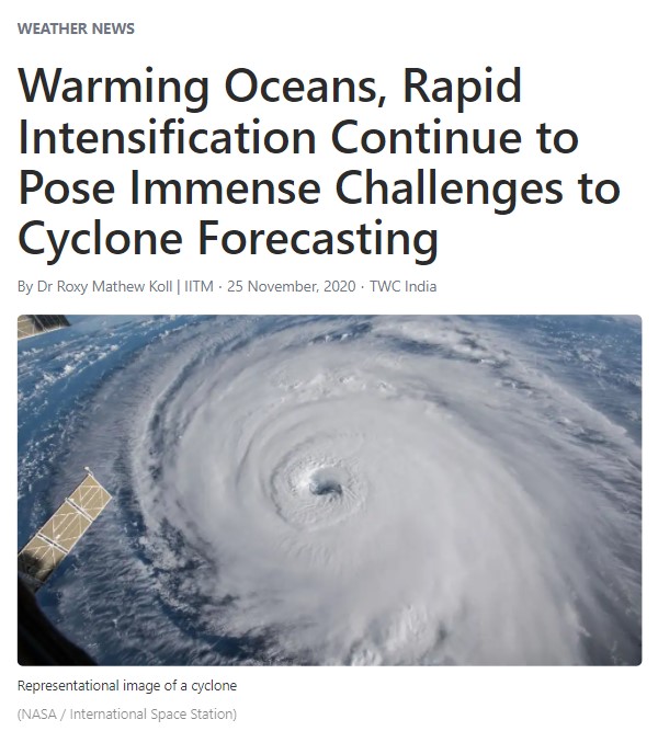
Warming Oceans, Rapid Intensification Continue to Pose Immense Challenges to Cyclone Forecasting
The skill of cyclone forecasting has improved tremendously in recent years. We lost some 10,000 lives to Odisha super cyclone in 1995, but now the numbers have come down to three-digits (about 844 for Ockhi and lower for others), thanks to efficient forecasts and disaster management. This improvement in prediction skill is due to meticulous monitoring of ocean conditions using satellites and on-site instruments, and also due to the tremendous efforts gone into the development of forecast models.
Despite the improvement in modeling, cyclones still present us with a massive loss in terms of lives and property. The Bay of Bengal hosts only 4% of the total tropical cyclones globally, but more than 80% of the fatalities are from this region. One of the reasons is the rapid intensification of cyclones due to climate change and ocean warming. Sometimes the system intensifies from a cyclone to a very severe cyclone within a short time, say 24 hours—this is called rapid intensification. This happened with Cyclone Ockhi in November 2017 and might be happening with Cyclone Nivar. Technically, if the cyclone wind speeds increase by 55 km/hr in 24 hours, we can term that as rapid intensification. In recent years, we see more of these cases, where cyclones are intensifying quite rapidly due to warm ocean conditions, and forecast models find it difficult to simulate it.
Let us look at the factors that lead to rapid intensification in the case of Cyclone Nivar. There are two conditions at play here—the largescale and local environmental conditions.
Now we have a La Niña with cool conditions in the Pacific that makes the largescale environmental conditions favorable for cyclogenesis in the Bay of Bengal. During the last forty years, five out of six cyclones of the severe cyclones that hit the Tamil Nadu coast coincided with La Nina like conditions in the Pacific. Hence, the cyclone is not a surprise; we were expecting it during this season in the Bay of Bengal.
Coming to the local conditions, that is where the role of climate change is visible. The Bay of Bengal is part of the warm pool region, where the surface temperatures are generally above 28-29°C in November and occasionally exceeding 30°C. These high temperatures are generally conducive for cyclogenesis. Cyclones draw their energy from warm ocean waters, converting the massive potential energy to kinetic form. On top of that, the global warming element is there in the Bay of Bengal. This time the temperature anomalies are about 0.5-1°C and in some regions reaching 1.2°C above normal. Every 0.1°C means additional energy for the cyclone to maintain and develop. This could be a crucial factor leading to the rapid intensification of Cyclone Nivar. We find this was the case of Cyclone Okchi where similar warm conditions favored its rapid intensification. We found that unusually warm ocean temperatures favored its evolution from depression to cyclone in 9 hours and then to a very-severe-cyclone in 24 hours.
Efficient forecasts require efficient monitoring of the ocean, but we have gaps there too. We can monitor and track these cyclonic systems due to the buoys and instruments in the oceans, satellites in the sky, and weather models running on high-performance computers. Global warming presents us with new challenges such as the rapid intensification of cyclones, which need to be closely monitored at higher resolution and accuracy using on-site platforms such as buoys and moorings. Improving the Indian Ocean Observing System (IndOOS) and incorporating the global warming signals in the weather models can help us tackle the challenges of intense cyclones in the future.
Originally published in The Weather Channel [link]